Things to Do in the North End, Block by Block
Past the cannoli lines and the brass Freedom Trail stripe is a working Italian-American neighborhood that rewards anyone willing to walk its side streets, not just its plaza.
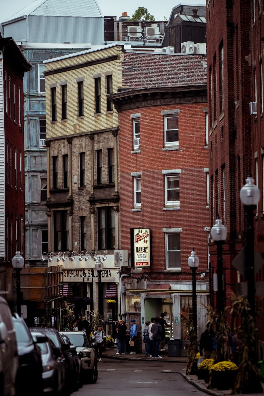
By six-forty in the morning, before the tour groups find parking and the Freedom Trail's brass-and-brick stripe starts collecting camera straps, Salem Street already smells like scorched sugar and yeast. A baker in a flour-dusted apron props open a side door to let the oven heat escape. Two men in matching Bruins jackets argue about the bullpen over espresso at a three-stool counter, and any honest rundown of things to do in the North End has to start here, on the side streets, before it ever reaches the plaza everyone photographs. A delivery truck idles outside a fish market on Fleet Street while a guy in rubber boots wheels crates of ice past a stoop where somebody's grandmother is out sweeping a sidewalk that isn't even hers. That's the real rhythm underneath the postcard, the one the brass Freedom Trail markers never capture.
This is Boston's oldest residential neighborhood, laid out before anyone thought to make the streets straight, and it has stayed Italian-American through waves of change that flattened plenty of other city neighborhoods into something interchangeable. The following is organized the way a local would actually walk it: the Revolutionary-era cluster first, because it's unavoidable and mostly worth it, then the streets where people actually eat and buy their groceries, then the water, then the practical stuff nobody tells you until you're standing at Haymarket wondering which direction to go.
Things to Do in the North End: The Freedom Trail Blocks
Four or five sites here sit within about six minutes' walk of each other, which is exactly why they get overrun by midday. None of that makes them skippable. Go early, or come back in the evening when the last tour groups have peeled off toward Quincy Market, and these places function the way they're supposed to: as a genuine record of a neighborhood that was already old when the Revolution started.
The Paul Revere House
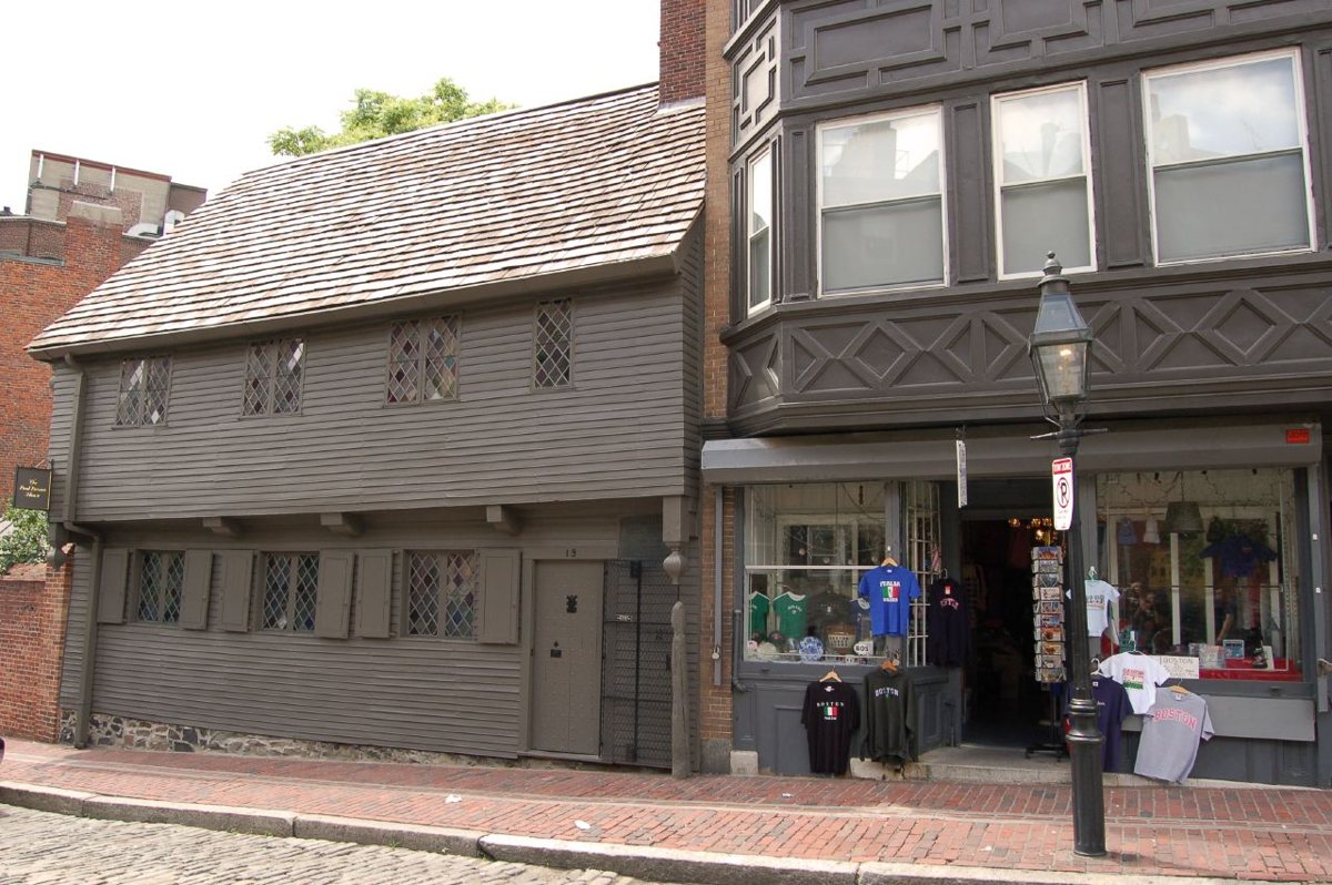
This is the actual house, on North Square, a squat wooden structure with diamond-pane windows that predates Revere's ownership by about a century. He lived here with his family before and during the years he made his famous ride, and the house has survived a stretch as a candy store, a cigar factory, and a tenement before preservationists intervened. Inside, the rooms are small and low-ceilinged in a way that makes the Revolutionary War feel less like a costume drama and more like something that happened to actual people who didn't have much space. Go inside if you can, not just for the photo out front. The insider move is to arrive right when it opens, before the square fills with the rest of the trail crowd, so you get a few minutes of the courtyard to yourself. It sits at North Square, a short block off Hanover Street and easy to find because it's the one everyone's phone is pointed at.

Just uphill and a couple of blocks north is the church that made Revere's ride matter in the first place, and it's worth separating the myth from what's actually there.
Old North Church
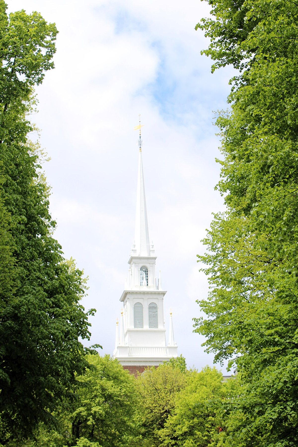
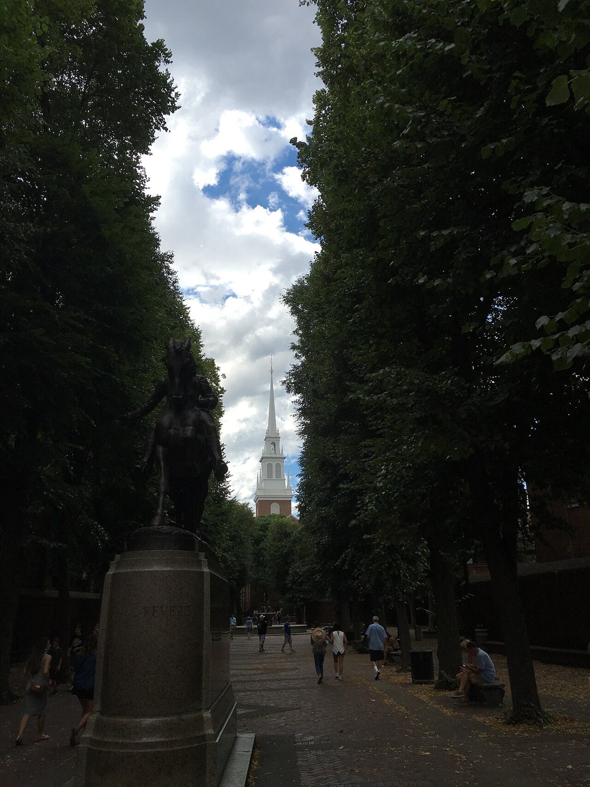
Officially Christ Church in the City of Boston, this is where two lanterns were hung in the steeple as a signal about British troop movements, the origin of "one if by land, two if by sea." The steeple visible today is a rebuild after storm damage decades later, and the church itself has gone through renovations that would make a strict originalist wince, but the building's role in the story is not in dispute and the interior box pews are genuinely worth seeing. Skip the gift-shop version of the story and read the actual placards; the neighborhood gets prickly about tourists who leave believing Revere himself climbed the steeple, which he didn't. The crypt tours, when offered, go into the burial vaults beneath the church, which is a stranger and better use of twenty minutes than the standard photo stop. It sits on Salem Street at the edge of where Salem meets Hull Street, visible from several blocks away because of the steeple.

Across Hull Street, on the hill itself, is where a lot of the people connected to both of these buildings actually ended up.
Copp's Hill Burying Ground
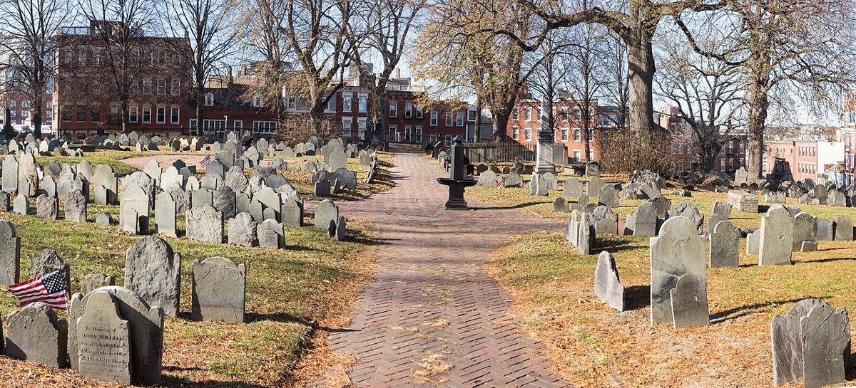
This is the second-oldest burying ground in the city, set on the highest point in the North End, and it holds thousands of colonial-era Bostonians including free Black residents from the New Guinea community that once surrounded it, along with generations of the Mather family and assorted sea captains and artisans. The slate headstones lean at angles that a hundred winters will do to soft stone, and some still show pockmarks that locals will tell you are old musket damage from British troops using the stones for target practice, a claim historians treat with more skepticism than the tour guides do. What makes it worth the climb is the view over the harbor as much as the graves and the way the ground drops off toward the water, giving you the clearest sense in the neighborhood of why this hill mattered strategically. Visit at an hour when it's quiet; mid-morning on a weekday works, and treat it as a cemetery rather than a photo backdrop. It's on Hull Street, a short uphill walk from the church.

Back down the hill and across Hanover, a much gentler patch of ground connects two of the neighborhood's most photographed spots.
The Paul Revere Mall
Locals call this the Prado, and it's a brick-paved civic space linking the Old North Church to Hanover Street, lined with plaques honoring North End residents who served in the World Wars. At its center is the bronze equestrian statue of Paul Revere, mid-ride, which is the one people actually mean when they say they took a picture with Paul Revere, since the statue is far more photogenic than the cramped house he lived in. Benches line the perimeter and older residents use it the way any neighborhood uses a plaza, to sit, to watch kids, to argue about the news. It's a legitimate rest stop between sites rather than a destination on its own, and it's free, shaded in parts, and rarely as crowded as the sites on either end of it. Find it directly behind the Old North Church, connecting through to Hanover Street.

St. Stephen's Church
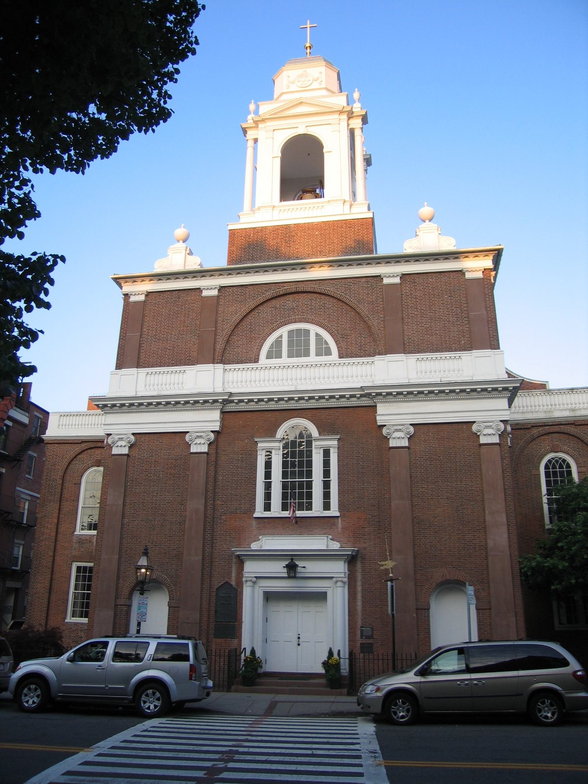
This is the only Charles Bulfinch-designed church still standing in Boston, and its curved brick facade on Hanover Street is easy to walk past without registering what it is. Rose Fitzgerald Kennedy, matriarch of the Kennedy family, was baptized here and her funeral Mass was held in the same building decades later, a detail that connects this unassuming parish to one of the city's most mythologized families in a way that has nothing to do with the Freedom Trail. The church has served waves of immigrant congregations over its history, another reminder that the North End's Italian-American identity is itself one chapter in a longer story of newcomers claiming this same handful of blocks. It's an active parish, so check current hours before planning around it, and be respectful of services in progress. It sits directly on Hanover Street, hard to miss once you know what you're looking at.

Hanover and Salem Streets: Where the Neighborhood Actually Lives
Once you're past the historical cluster, the North End stops being a museum and starts being a neighborhood again, and that shift happens almost entirely along two parallel streets that run the length of the peninsula.
Hanover Street
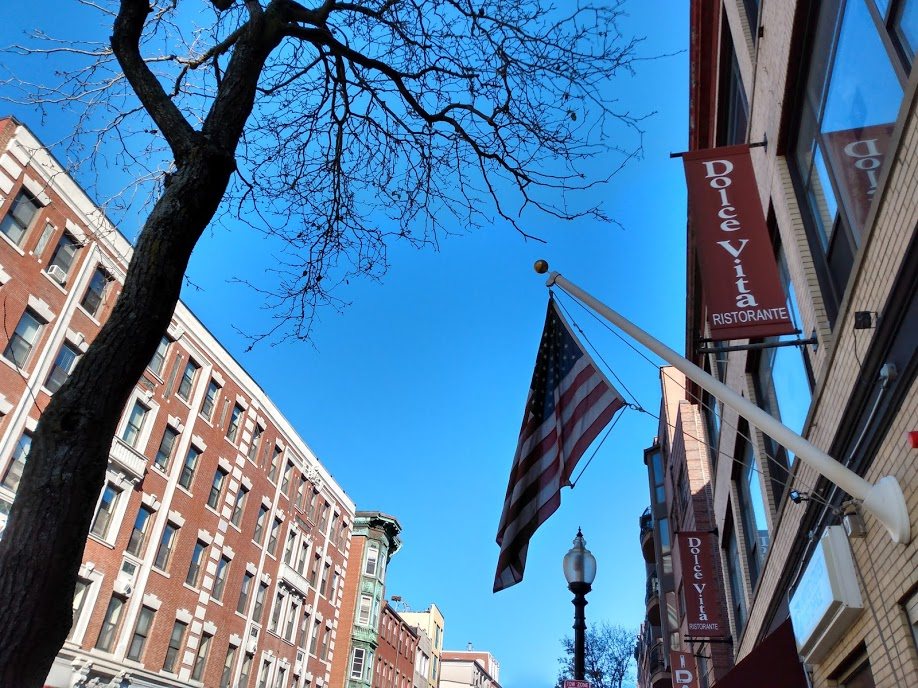
This is the commercial spine, lined with restaurants whose outdoor tables spill into the sidewalk from spring through fall, coffee bars where the regulars have their orders memorized, and the Italian bakeries that make this neighborhood's pastry culture a genuine point of civic pride rather than a marketing line. The cannoli rivalry between the two most famous bakeries on this street is not manufactured for tourists. It is a real, decades-old, mildly ridiculous argument that longtime residents have actual opinions about, and the smart move is to try more than one shop before declaring a favorite, because the correct answer changes depending on who's asking and whether their cousin works there. In the evening the street functions almost like a passeggiata, people walking slowly, greeting each other, in no hurry to get anywhere, which is a different pace than the daytime tourist shuffle. If you want a fuller sense of the block-by-block food landscape, the neighborhood's pastry counters are worth a dedicated pass on their own. Hanover Street runs the length of the neighborhood, roughly from the Greenway to the waterfront end near the Coast Guard base.

Salem Street
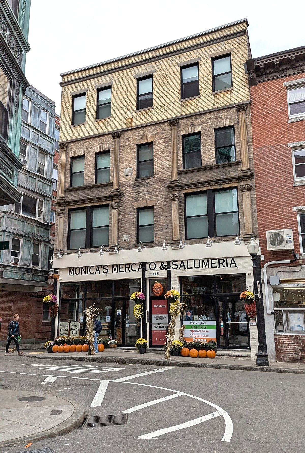
One block over and narrower, Salem Street has a different character entirely, quieter, more residential in feel, with the kind of small specialty shops, salumerias, and family-run groceries that don't need a storefront sign the size of a billboard to stay in business. This is where a lot of the neighborhood's actual daily shopping happens, and it's a better street for slowing down than for checking off a list. The contrast between Salem and Hanover, one loud and restaurant-heavy, one quiet and residential, is the clearest single illustration of how the North End operates as a real neighborhood rather than a themed district. Walk it in the late morning when the shops are open but the evening rush hasn't started. It runs roughly parallel to Hanover, one block toward the water, and connects near the Old North Church.

The Summer Feasts
Saint Anthony's Feast and the Fisherman's Feast are long-running summer traditions here, weekend-long street festivals rooted in the religious processions that Italian immigrant societies brought with them generations ago. Statues of the saints are carried through the streets on the shoulders of parishioners while crowds pin money to ribbons trailing off the platforms, brass bands play, and every available inch of sidewalk fills with food stalls selling sausage and peppers and fried dough. These aren't reenactments staged for visitors. They're organized by the same Italian societies that have run them for generations, and the neighborhood treats them as a genuine calendar highlight rather than a tourist event, even though outsiders are welcome. If your visit happens to line up with feast season, check current schedules since exact weekends shift year to year, and expect Hanover and the side streets to be closed to traffic and packed shoulder to shoulder.
The Water's Edge: Parks, Ballfields, and the Greenway
After the density of Hanover and Salem, the neighborhood opens up dramatically at both ends, first at the modern park system that now separates it from downtown, then at the harbor itself.
The Rose Kennedy Greenway
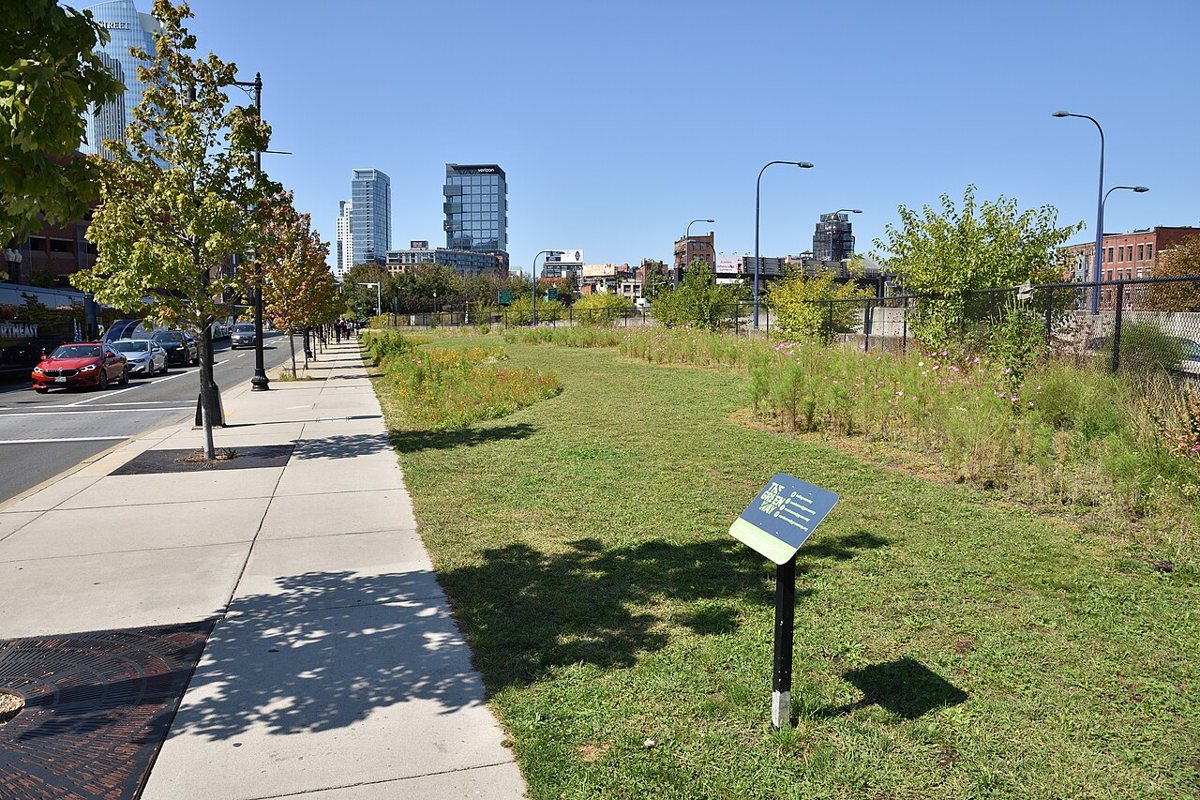
This ribbon of parks now occupies the footprint of the old raised Central Artery highway, torn down as part of the Big Dig, and it functions as the North End's actual boundary line, both physically and psychologically, separating the neighborhood from the Financial District and Faneuil Hall. It's a genuinely pleasant stretch of gardens, public art, food trucks, and in warmer months a small carousel, and it's the route most people unknowingly take walking from Government Center or Haymarket into the North End proper. Locals use it as a shortcut and a lunch spot in roughly equal measure. It's free, always open, and one of the few genuinely successful pieces of the Big Dig's aftermath. It runs along the neighborhood's western edge, between the North End and downtown.

The North End Waterfront and Christopher Columbus Waterfront Park
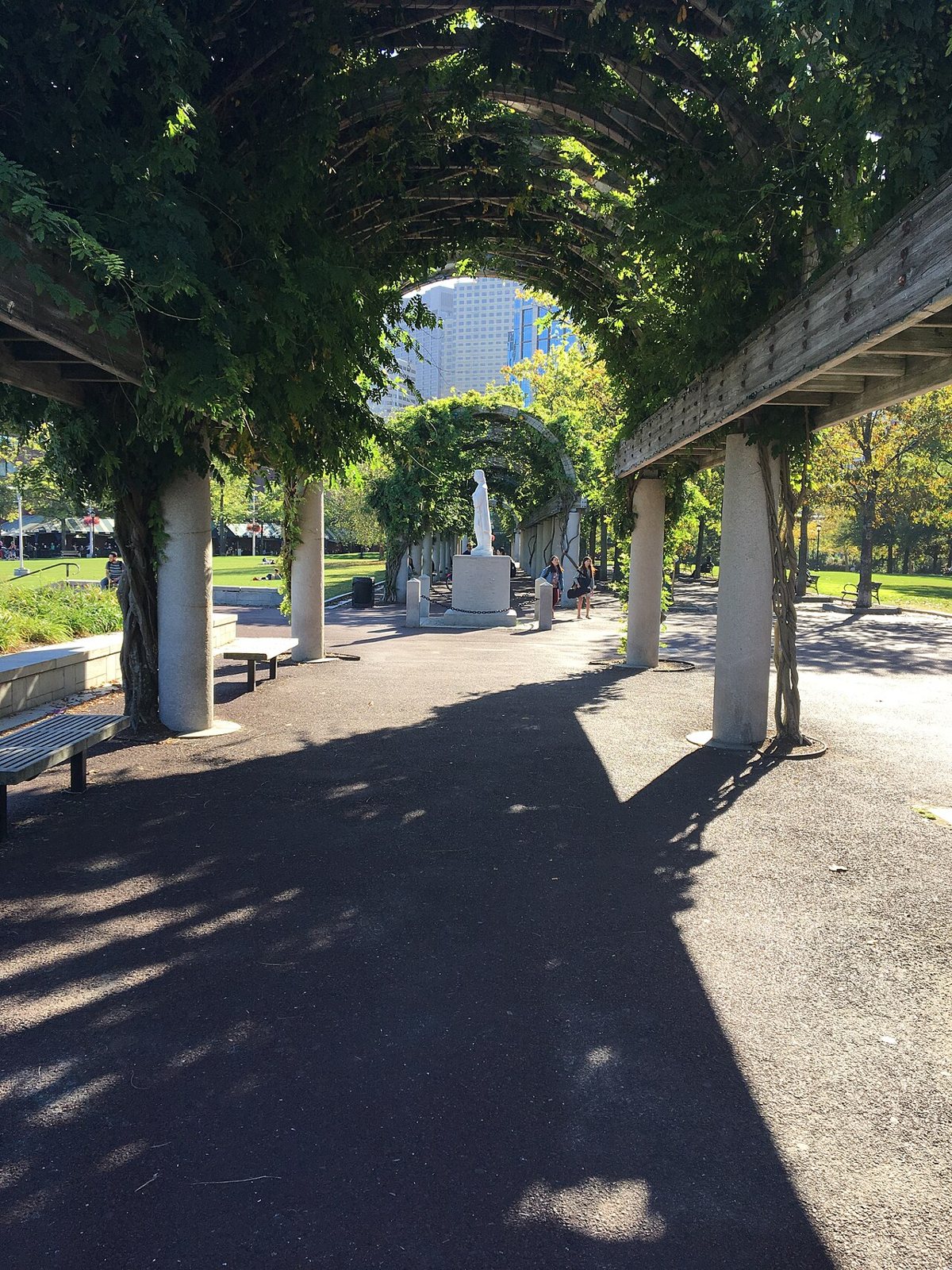
On the harbor side, this stretch of green space and harborwalk gives you the view that the inland streets never do, open water, working boats, planes lined up on approach to Logan across the channel. There's a wisteria-covered pergola that's become a modest landmark in its own right, and benches that fill up with people eating takeout from the restaurants a few blocks inland. It connects to Long Wharf and the rest of the downtown harborwalk, so it's an easy add-on rather than a separate trip. Come at sunset if the timing works out, when the light hits the water and the crowds from the historical sites have mostly cleared out. It runs along the water past the marina, a short walk from the base of Hanover Street.

Langone Park and Puopolo Park
These connected ballfields sit right on the water, and they're the clearest evidence that the North End is a lived-in neighborhood and not a preserved district. Bocce courts run alongside baseball diamonds, kids play pickup games within sight of the harbor, and older men gather at the courts most afternoons in a scene that hasn't changed much in decades. It's not a tourist attraction in any conventional sense, and that's the point of including it. Sit on a bench, watch a game, and you'll understand the neighborhood's rhythm better than an hour in any historical site. It sits along the waterfront near the northern tip of the peninsula.
Getting Around: T Stops, Walking Routes, and Timing
The North End is small enough to walk end to end in about fifteen minutes, which is both its charm and the reason parking here is close to pointless. The two practical T stops are Haymarket, on the Orange and Green Lines, which drops you right at the Greenway edge closest to Salem Street and the Boston Public Market, and North Station, on the Orange and Green Lines plus the commuter rail, which puts you closer to the waterfront end near the ballfields. From downtown or Faneuil Hall, it's a flat, short walk across the Greenway, no more than ten minutes from the Aquarium or Government Center. The Freedom Trail's brick-and-brass line does run straight through here, tying the Old North Church and the Paul Revere House into the same route tourists walk from the Common. It's worth following if you're doing the full trail. It is not, on its own, a North End experience, and treating it as the whole neighborhood is the single most common mistake visitors make. There are forty other reasons to be here that have nothing to do with the trail's brass markers.
The Boston Public Market
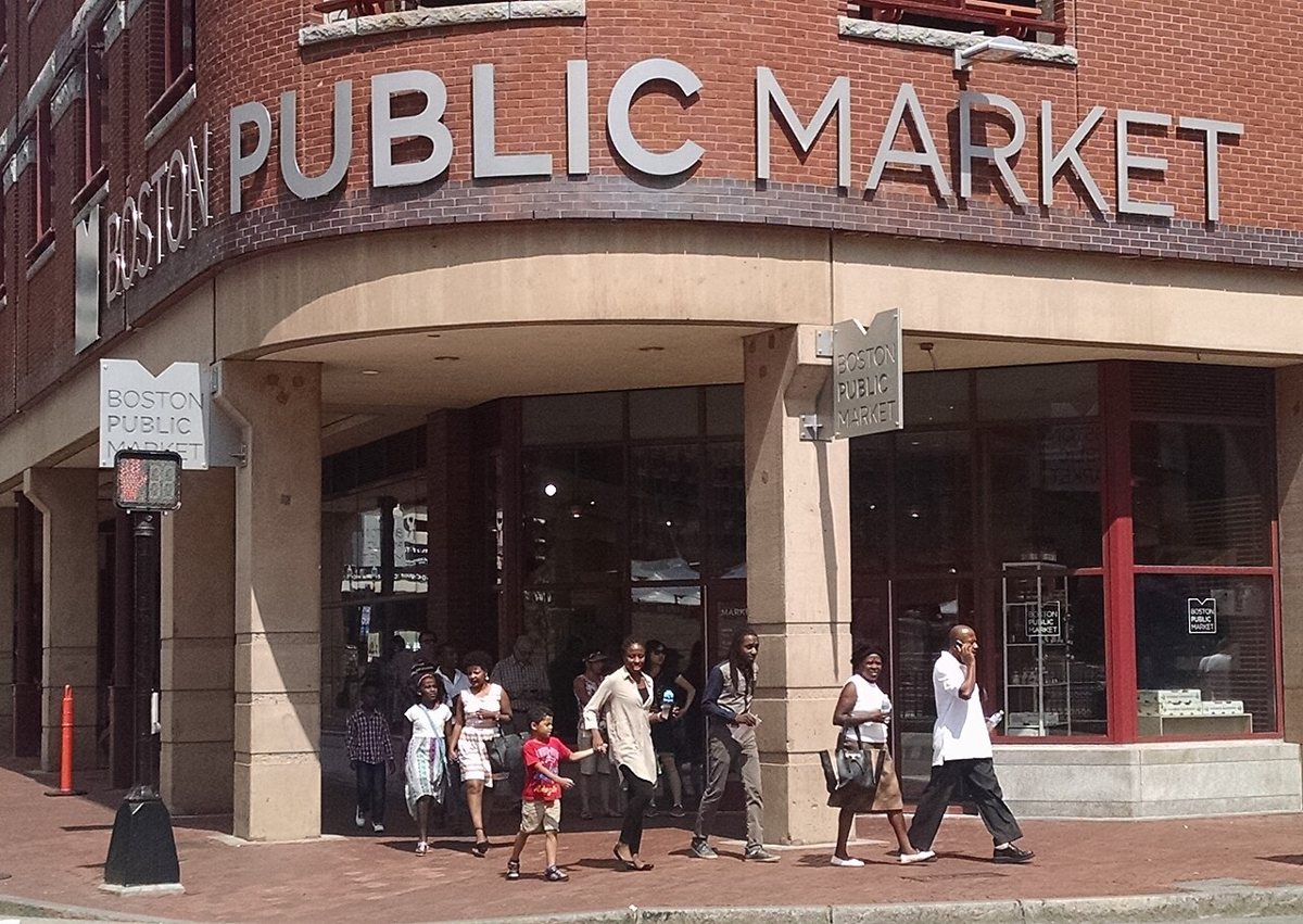
Technically at the neighborhood's edge near Haymarket rather than inside the North End itself, this indoor market is worth folding into the same trip since it sits directly on the walking route in from the T. It's a year-round collection of local food vendors and producers, a useful contrast to the Italian groceries a few blocks away and a good option when the weather turns and an outdoor stroll loses its appeal. It's not trying to be the North End's version of anything. It's its own thing, sitting conveniently in the gap between the T stop and the neighborhood's first blocks.

- Skip driving. Street parking is scarce and expensive, and the T from either Haymarket or North Station is faster than circling for a spot.
- Wear shoes you can walk in. The sidewalks are narrow, uneven in places, and not built for anyone in a hurry.
- Early morning or early evening beats midday for the historical cluster, when the Freedom Trail groups thin out.
- The churches are usually free to enter, though donations are appreciated and hours vary, so check current hours before planning a visit around them.
- The waterfront parks and ballfields are always free and always open.
- If your trip lines up with one of the summer feasts, expect street closures and plan extra walking time around Hanover Street.
The Bottom Line
The North End works because nobody here asked permission to become a theme park. It survived being flattened by a highway overhead for decades, it survived waves of gentrification that hollowed out other old ethnic neighborhoods, and it still runs on bakery ovens firing before dawn and bocce games at Langone Park that have nothing to do with anyone's itinerary. See the historical sites, they earned the attention. But budget real time for Salem Street's quiet shops, for a proper sit-down dinner instead of a photo outside a bakery window, and for a bench at the waterfront where the only agenda is watching the harbor. The version of the neighborhood worth remembering is the one still functioning after the last tour bus pulls away.